This is a blog set up by Eli Fuller (me) to help keep readers informed and to promote our little country to prospective guests. It's also to make sure that new info about our island is passed on quickly and also to receive feedback on this info. Of course most of the things i write about have themes of ecology and usually have quite a bit to do with my company Adventure Antigua. Make comments anytime you want, but check the site above to book your adventure.
Monday, August 31, 2009
Possible Tropical Storm warning coming soon
After reading the weather discussion on www.crownweather.com and looking at the moving sat maps on www.weathercarib.com i think we should all be thinking about getting ready for a storm. I will post updates here and on www.stormcarib.com so keep checking the sites.
Friday, August 28, 2009
balsa wood for a scaled down model boat
Wednesday, August 26, 2009
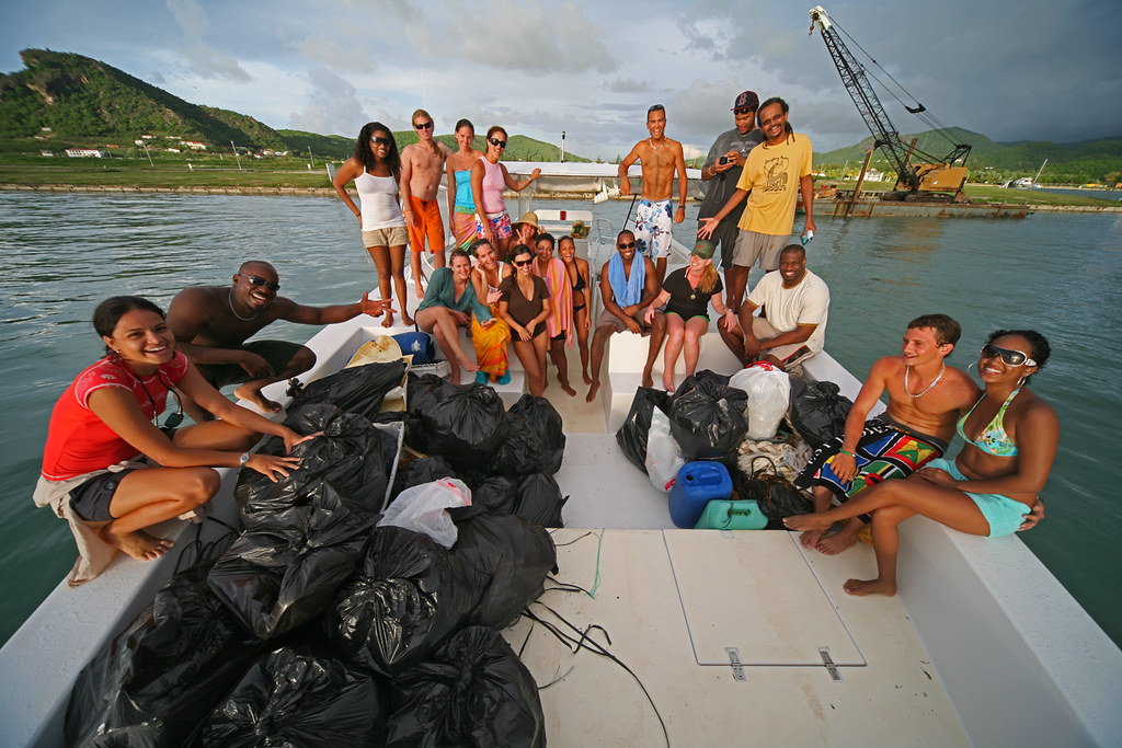
Come help out on International Coastal Cleanup Day Spet. 19th
If you are interested in coming out with us on the 19th of September to one of the off shore beaches to do a cleanup and then a bit of snorkeling possibly contact my sister Nell who handles the bookings on 1 268 726 6366 or info@adventureantigua.com and make a reservation.
This photo was from two years ago and shows a group of us and the garbage we collected from just one beach at Green Island.
Tuesday, August 25, 2009
Building your own power boat
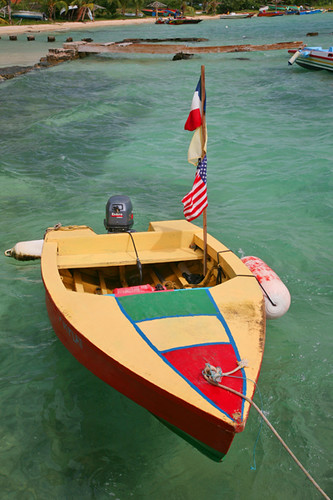
As you can see, the young desingers there love to make their boats full of colour, and there is quite a bit of competition and pride encompassed in building them.
Here is another one anchored off the west coast of Carriacou at sunset:
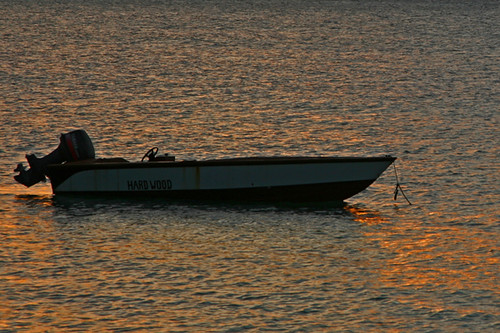
Simple boats but very functional in our choppy waters. With plenty of deep V up in the front of the boat these little vessels cut through the water very well.
Here are photos of some in Grenada:
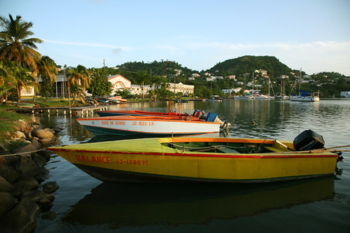
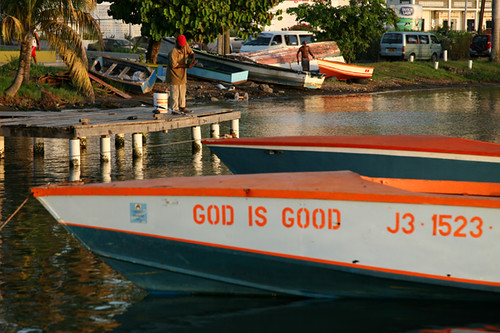
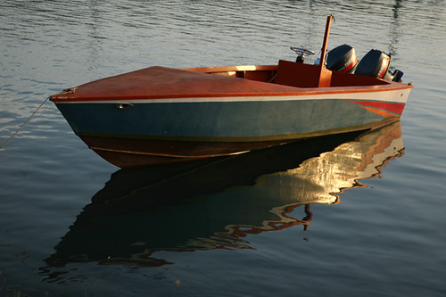
Most of the fast more modern ones are built using a two by four skeleton and a ply wood skin covered in some fiberglass to keep the wood from rotting. The older ones are built the old school way as our sloop was. No ply wood and no fiberglass. Ones like this have been built the same way for hundreds of years:
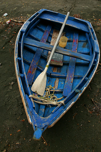
The slower and older boats are all like this:
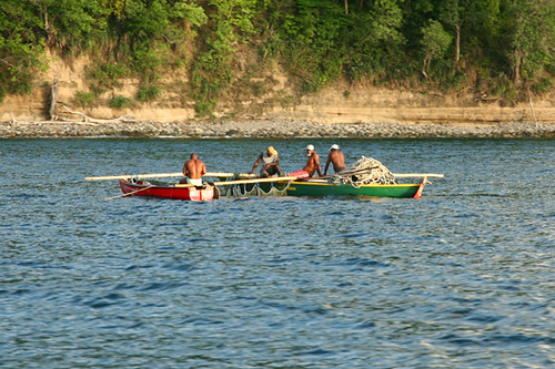
Anyway, without having any experience in boat building I was very interested to listen carefully to my boat's designer speak about making models so that he could scale from there to the big boat. Seen here the model of my new sailing boat still being built is carefully designed with 16th of an inch to one inch scale.
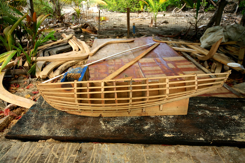
Notice any resemblance?
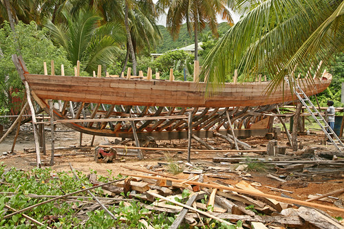
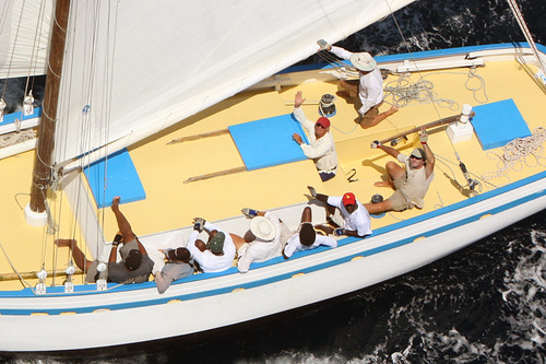
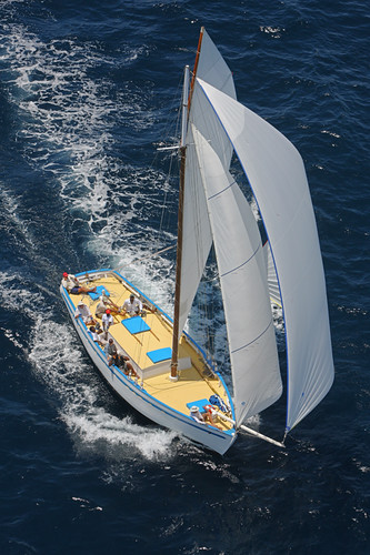
Hopefully by the end of this yeat she will look something like her sister (our other boat) Ocean Nomad seen here below in photos taken by www.photoaction.com :
Anyway, with some of the things i learnt i decided to start building my own small powerboat. Last week my sister Nell told me that she wanted to go boating with some of her friends and that it wasn't fair that we didn't have a small boat she could use. I agreed! Not only that, when it's calm and i want to go fishing by myself i always think it's crazy to use one of the big boats.
Tomorrow i will show you the simple model i have made. It took me about three days of work on and off, but a scaled model has been almost finished of what will be a fun 14 foot speed boat which will be perfect for fishing and playing.
For more info on our wooden boats check http://www.sailing-antigua.com/ and http://www.adventureantigua.com/
Tuesday, August 18, 2009
Adventure Antigua is happy

Yup with two storms that were first forecast to come and ruin our nice summer now no threat to us, we at Adventure Antigua are jumping for joy.
Tropical Storm Ana died and Hurricane Bill is turning away from the Caribbean and is of no threat to us according to all forecasts.
The Eco Tour went out yesterday and Xtreme is out today. Tomorrow we are doing maintenance and thursday there is a cruise ship in town and all hands will be on deck as we have Xtreme, Eco and Classic Yacht all out.
Monday, August 17, 2009
Weakening Tropical Depression Ana leaves the area

These lines are each organization's forecast track based on the super computing done by their tools. It's extremely technical work and after plugging in a huge variety of weather factors from all over the Atlantic and further, they come up with the forecasts. They are usually pretty accurate. With that in mind we should always prepare when a storFor more info you can check this link. m is east of the islands no matter what the forecasts say. It's like turning your back on a raging bull that's tied. Anyway, i'm keeping my eye on Bill even though i feel pretty confident that he will not come close to us at all. Apart from that we have pretty good weather on the cards for the next week.
Sunday, August 16, 2009
Big positive change in forecast for Antigua.
 The IR satellite map below shows very little cloud cover associated with Ana either, but I think Dominica and Guadeloupe will get some squally weather later tonight and tomorrow. We here in Antigua may or may not get much at all. We will have to see. That being said you are wise to prepare for some 40 - 50 mph squalls just in case.
The forecast track for ana is here and for bill is here. Currently the weather is mostly sunny here in Antigua with a very light north wind. Some boaters are securing their boats and the others are out enjoying the use of them on this sunday. The rest of the week now looks fairly normal according to all forecasts but we will have to keep an eye on Bill as he's still east of us and you can never 100% trust the forecasts.
Saturday, August 15, 2009
Tropical Storm Ana threatens Antigua and Barbuda
The old TD 2 had strengthened and was forecast to pass right over Antigua and Barbuda as a Tropical Storm on Monday!!!! This wasn't expected, and at this hour most people on the island are unaware of this.
Here is the National Hurricane Center 11 am forecast:
000
WTNT32 KNHC 151432
TCPAT2
BULLETIN
TROPICAL STORM ANA
ADVISORY NUMBER 14
NWS TPC/NATIONAL HURRICANE CENTER MIAMI FL AL022009
1100 AM AST SAT AUG 15 2009
...ANA...PRONOUNCED AH-NA...MOVING
QUICKLY WESTWARD WITH LITTLE
CHANGE IN STRENGTH...
INTERESTS IN THE
LEEWARD ISLANDS...THE VIRGIN ISLANDS...AND PUERTO
RICO SHOULD MONITOR THE
PROGRESS OF ANA. A TROPICAL STORM WATCH MAY
BE REQUIRED FOR PORTIONS OF THE
LEEWARD ISLANDS LATER TODAY.
FOR STORM INFORMATION SPECIFIC TO YOUR AREA
IN THE UNITED
STATES...INCLUDING POSSIBLE INLAND WATCHES AND
WARNINGS...PLEASE
MONITOR PRODUCTS ISSUED BY YOUR LOCAL NATIONAL WEATHER
SERVICE
FORECAST OFFICE. FOR STORM INFORMATION SPECIFIC TO YOUR AREA
OUTSIDE OF THE UNITED STATES...PLEASE MONITOR PRODUCTS ISSUED
BY YOUR
NATIONAL METEOROLOGICAL SERVICE.
AT 1100 AM AST...1500 UTC...THE CENTER
OF TROPICAL STORM ANA WAS
LOCATED NEAR LATITUDE 14.3 NORTH...LONGITUDE 48.3
WEST OR ABOUT
920 MILES...1480 KM...EAST OF THE LEEWARD ISLANDS.
ANA
IS MOVING TOWARD THE WEST NEAR 16 MPH...26 KM/HR. A TURN TOWARD
THE
WEST-NORTHWEST IS EXPECTED DURING THE NEXT COUPLE OF DAYS.
THIS MOTION COULD
BRING THE CENTER OF ANA NEAR THE LEEWARD ISLANDS
ON MONDAY.
MAXIMUM
SUSTAINED WINDS ARE NEAR 40 MPH...65 KM/HR...WITH HIGHER
GUSTS. SOME SLOW
STRENGTHENING IS FORECAST DURING THE NEXT
48 HOURS.
TROPICAL STORM
FORCE WINDS EXTEND OUTWARD UP TO 70 MILES...110 KM
FROM THE CENTER.
ESTIMATED MINIMUM CENTRAL PRESSURE IS 1005 MB...29.68 INCHES.
...SUMMARY OF 1100 AM AST INFORMATION...
LOCATION...14.3N 48.3W
MAXIMUM SUSTAINED WINDS...40 MPH
PRESENT MOVEMENT...WEST OR 270 DEGREES
AT 16 MPH
MINIMUM CENTRAL PRESSURE...1005 MB
THE NEXT ADVISORY WILL
BE ISSUED BY THE NATIONAL HURRICANE CENTER AT
500 PM AST.
$$
FORECASTER BEVEN
You can see the forecast track here showing times and intensity forecasts here in this image:

Another good tracking map for Ana is this one.
Some good sites to go to are http://www.weathercarib.com/ http://www.nhc.noaa.gov/ and
http://www.wunderground.com/tropical/ and of course you can see local reports on http://www.stormcarib.com/
For now the weather couldnt be better and i have seen many people going out here in jolly harbour today on their boats. I will post more on the stormcarib site later today.
Friday, August 14, 2009
Extreme forecast for Northern Caribbean August 19th and 20th
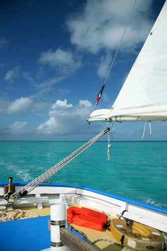
The photo above was taken as we arrived in from our 15 day adventure sailing trip all the way down to Grenada and back thru the Caribbean. We knew it was a risky time to be doing it because of possible storms and even before we arrived home we started hearing of one brewing over the west coast of Africa. Actually, at that time it was just the seeds of a storm, but now its a very strong tropical wave forecast to get stronger.
With most of the high tech computer models saying that the northern leeward islands are going to be hit by a cat 2 hurricane on wednesday, i think we better start doing what my dad has done already. Get supplies that you will need to see you safely through a hurricane if you haven't gotten them already. Although there is still plenty of time for things to change most suggest that a tropical wave far out in the eastern atlantic will turn into a hurricane fairly soon and track towards the northern leeward islands. We are in the northern leewards and should monitor this situation carefully. For more on this system check http://www.crownweather.com/?page_id=325 and http://www.wunderground.com/tropical/tracking/at200990_model.html IF you are on a yacht cruising here you still have time to sail/power south but go far south. I have reserved to take two boats out the water on monday and tuesday. One up at Parham and another in Jolly. I am still hoping it will just be a good bit of hard core windsurfing weather, but it could be worse. Keep checking the weather sites...
Windguru is saying 60 knots and almost 30 foot waves! For info on how to use windguru (since so many people keep saying they can't figure it out) check: http://antiguaisland.blogspot.com/2008/07/understanding-windguru-and-weather-in.html
Remember that a hurricane usually gives bad conditions for a day and then is gone. The forecast is still a ways off but Antigua is forecast to get tropical storm winds which are less than 75 mph. We can handle that, so lets hope that IF we are to get hit... 75 is the max we get. For more info and updates from me and others on this you can check http://www.stormcarib.com/
268 725 7263 Cell
The powerboats: http://www.adventureantigua.com
The sailing: http://www.sailing-antigua.com
The Blog: http://www.antiguaisland.blogspot.com
Twitter: http://www.twitter.com/antigua
Thursday, August 13, 2009
a slide show with photos related to Adventure Antigua
To get your own photos of this kinda thing book a tour with www.adventureantigua.com getting the online direct booking discounts and come to Antigua!
Monday, August 10, 2009
terrible weather over st lucia and southern caribbean
Sunday, August 09, 2009
mobile phone blogging from da boat
Friday, August 07, 2009
Sailing Adventures
www.adventureantigua.com